_Page_01.jpg?height=675 "Residential Development Opportunity")
_Page_06.jpg?height=675 "Residential Development Opportunity")
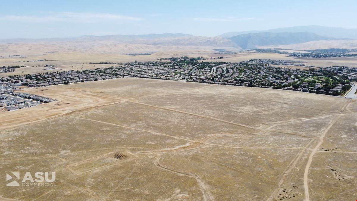
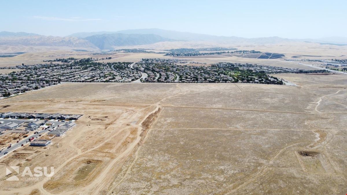
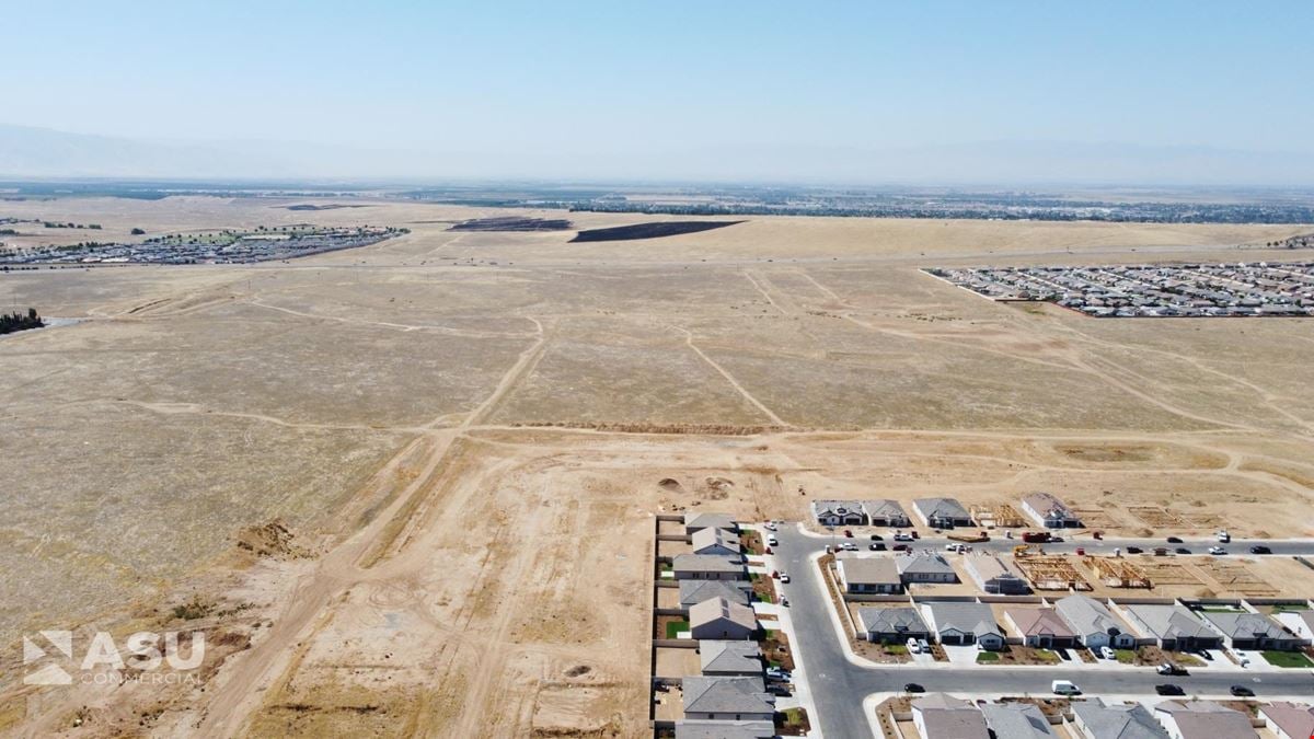
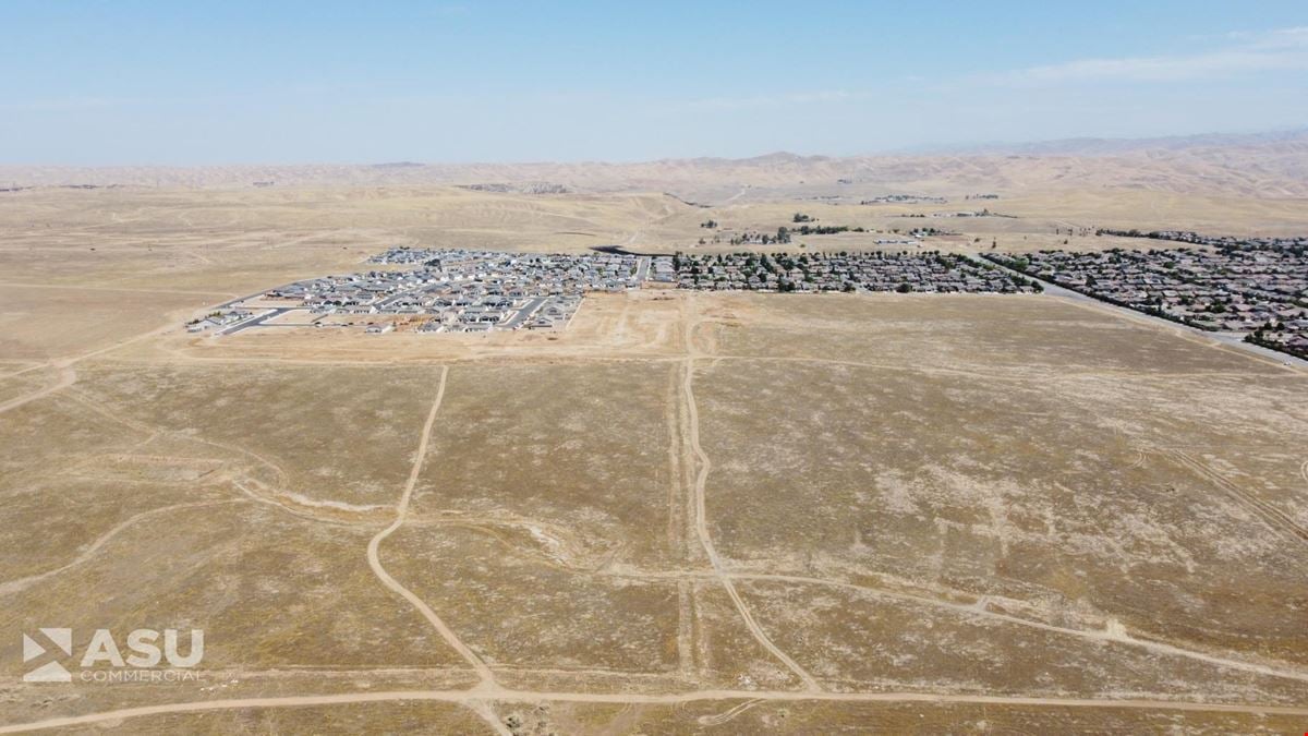
_Page_03.jpg?height=675 "Residential Development Opportunity")
_Page_05.jpg?height=675 "Residential Development Opportunity")
_Page_02.jpg?height=675 "Residential Development Opportunity")
_Page_07.jpg?height=675 "Residential Development Opportunity")
Contacts

ASU Commercial
Vice President
Property Details
- Property Type Land - Residential (land)
- Property Size 872,506.8 SF
- Lot Size 20.03 Acre
- Zoning R-1 & R-2, City of Bakersfield
- Date Updated Sep 20, 2026
Located west of Vineland Road and City Hills Drive in Northeast Bakersfield, this ±20.03-acre residential development opportunity offers a position within a growing area of Bakersfield surrounded by established neighborhoods and newer residential tracts. The property is zoned R-1 and R-2 by the City of Bakersfield, providing flexibility for a variety of residential concepts, including single-family homes, custom-home communities, gated projects, and higher-density residential development. An expired tentative tract map (Tract No. 6780) provides additional planning history for the site.
The property benefits from proximity to schools, retail, restaurants, and everyday services, along with existing and planned utility infrastructure in the surrounding area. Northeast Bakersfield's residential base and favorable demographics further support the site's long-term development potential; within one mile, the area has an average household income of approximately $177,733. With its location, zoning, surrounding residential growth, and development flexibility, the site represents an opportunity for homebuilders, residential developers, and land investors seeking development land in Bakersfield, California.
Reach out to the broker for more info on lease terms and amenities
Highlights
- Growing Northeast submarket with strong owner-occupancy, executive housing, and above-average household incomes supporting long-term residential demand
- Strong residential demand drivers both existing and planned include nearby schools, retail centers, restaurants, and other daily services
- Surrounded by existing and planned utility infrastructure, offering substantial cost savings
- Flexible development potential for single-family homes, custom home communities, gated projects, or higher density residential projects
- Surrounded by established housing communities, including several newly constructed housing tracts
- Expired Vesting Tentative Tract Map (Tract #6780)
Attachments
Getting around
-
1/100

Walk Score ®
-
27/100

Bike Score ®
Location
- City Bakersfield, CA
- Neighborhood Morning Star
- Zip Code 93306
- Market Central Valley
Points of Interest
-
Bakersfield
6.39 miles
-
Chevron
1.25 miles
-
Shell
1.64 miles
-
Circle K
1.69 miles
-
Fastrip
1.69 miles
-
Speedway
3.70 miles
-
ChargePoint
5.53 miles
-
AMPM
6.26 miles
-
Arco
7.62 miles
-
Bakersfield, CA - Camino Del Rio Ct Supercharger
8.37 miles
-
Weedpatch Highway (Nw) Park And Ride
3.58 miles
-
Weedpatch Highway (Se) Park And Ride
3.66 miles
-
Stadium Parking Lot (Permit Required)
3.80 miles
-
Staff Parking Only
3.81 miles
-
North East Parking Lot (Permit Required)
3.85 miles
-
Maintenance Parking
4.07 miles
-
Guest Parking Lot
4.12 miles
-
South West Parking Lot
4.13 miles
-
Los Hermanos Parking Lot
5.82 miles
-
Burger King Parking Lot
5.82 miles
-
Hampton
3.55 miles
-
Best Western Plus Hill House
6.44 miles
-
Quality Inn & Suites Near Downtown Bakersfield
6.52 miles
-
Bakersfield Marriott at the Convention Center
6.60 miles
-
Padre Hotel
7.05 miles
-
Historic Downtowner Inn
7.06 miles
-
Super 8
7.13 miles
-
Quality Inn & Suites
7.93 miles
-
La Quinta Inn Bakersfield South
8.05 miles
-
Red Lion Hotel Bakersfield
8.05 miles
-
Target
3.11 miles
-
Big Lots
3.35 miles
-
Walmart Supercenter
3.46 miles
-
Dollar General Market
3.48 miles
-
Albertsons
3.69 miles
-
Smart & Final
3.91 miles
-
Foods Co
4.17 miles
-
Walmart Neighborhood Market
4.35 miles
-
Robert's Market
4.61 miles
-
Stop & Shop Market
6.21 miles
ASU Commercial
Vice President
